
Adelaide River
Alice Springs Mulga
Alpine Peatland
Arcturus
Beacon Farm
Boyagin Wandoo Woodland
Calperum
Cape Tribulation
CIA (maize and wheat)
CIA (rice)
Collie
Cow Bay
Cumberland Plain
Daly River Pasture
Daly River Uncleared
Dargo
Dry River
Fletcherview Tropical Rangeland
French Island
Fogg Dam
Gatum Pasture
Gingin
Great Western Woodlands
Howard Springs
Kopuatai
Lauder
Litchfield
Mangawhai
Mitchell Grass Rangeland
Nimmo
Otway
Oxford
Ridgefield
Riggs Creek
Robson Creek
Samford
Scott Farm
Silver Plains
Sturt Plains
Ti Tree East
Tumbarumba
Virginia Park
Wallaby Creek
Warra
Whroo
Wombat
Yanco
Yarramundi
![]() = external link, new window
= external link, new window
Introduction | Contacts | Purpose | Site Description | Measurements | DEM | Pictures
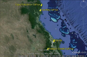
This map from Google. Map data: Landsat, SIO, NOAA, U.S. Navy, NGA, GEBCO
The Robson Creek flux station commenced continuous collection of data in August 2013. The flux tower is located at Robson Creek, 24 km northeast of Atherton on the western slopes of the Lamb Range in Danbulla National Park, within the Wet Tropics World Heritage Area.
The site is managed by James Cook University ![]() .
.
The Robson Creek site is supported by TERN ![]() .
.
Assoc. Prof. Michael Liddell
Principal Investigator ‐ OzFlux FNQ
James Cook University Cairns Campus
PO Box 6811
Cairns QLD 4870
ph: +61 7 4232 1275
Supported by

A contributor to

Partner organisations